From Spring to What's Supposed to Be Spring: Texas to Wisconsin

It's been a while since I've visited Wisconsin. It was last October to be exact. This was when I stopped in Marshfield on my way to Thunder Bay to get the amethyst for Victoria's engagement ring. Beyond that, I pretty much snow birded and stayed where it was warm in Texas.

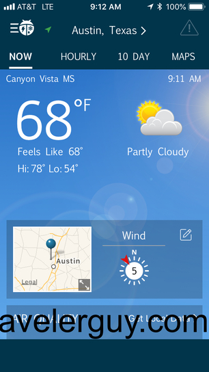
We actually did get snow in Texas in the winter, but nothing like they got in Wisconsin the week before I came. They ended up setting records with almost 2 feet of snow in April! Even without the snow, I knew there was going to be a huge shift in the weather. While the storms were mostly past, I checked what weather I would encounter. It was much colder than Austin!

Weather app showing Austin, Texas at 68°F with partly cloudy conditions, wind speed of 5 mph, and map location marker Ten-day weather forecast for Austin showing temperatures ranging from 66-78°F with partly cloudy to stormy conditions from April 18-27, 2018 Weather app displaying Marshfield, Wisconsin at 30°F with cloudy conditions, wind speed of 14 mph, and map location marker Ten-day weather forecast for Marshfield, Wisconsin showing temperatures from 26-53°F with light snow, sunny, and partly cloudy conditions from April 18-27, 2018 Weather radar map showing precipitation coverage across the United States with location markers in Wisconsin, Chicago area, and southern United States

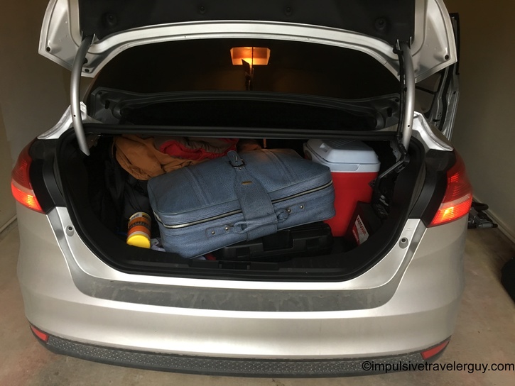
Wednesday I left for Wisconsin. It was a cloudy day but overall not too bad. I packed the car and got ready to go. I had to get fingerprinted for a new contract job I was picking up. I did that and got a carwash before hitting the road and heading north.

Open car trunk packed with luggage including blue suitcase, red cooler, and orange backpack prepared for road trip Strip mall exterior featuring Boulevard Bar and Grill with parked cars in front on overcast day Parking garage entrance with green entrance sign, clearance bar, and red X indicator showing entrance is closed Highway view under stormy gray clouds with street lights along divided roadway

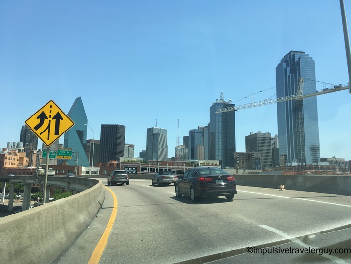
I decided to be a cheapskate and avoid tolls. Instead of going through Fort Worth, I went through Dallas and went up US75 into Oklahoma. Eventually, I'd go on US69 and then US169. The roads became two-lane highways, but overall it was a very scenic drive.

Approaching Dallas skyline on highway with modern skyscrapers, construction crane, and lane merge warning sign Driving on Dallas highway with downtown office buildings and hotels visible alongside roadway Highway bridge crossing with historic brown truss bridge visible alongside modern concrete bridge structure Highway view approaching Oklahoma state welcome sign reading Oklahoma Native America with green trees along roadside Open prairie landscape with two-lane highway stretching into distance under clear blue sky Long concrete causeway bridge crossing large body of water under clear sky Rural two-lane highway following truck through flat agricultural fields in early morning light Curved country road with cow visible in adjacent pasture and fencing along rural property Small town main street with houses, power lines, and buildings visible along two-lane highway Straight rural highway through agricultural land with grain silos and cattle visible in distant fields Tree-lined rural road with bare branches creating canopy overhead in early spring

My route took me through Tulsa. Of course, I had to play Tulsa Time by Don Williams.

Car dashboard display showing 70°F temperature, 6:25 time, playing Tulsa Time by Don Williams on track 8/12 via USB connection Interstate highway with overhead directional signs for Route 69 and local exits under clear blue sky

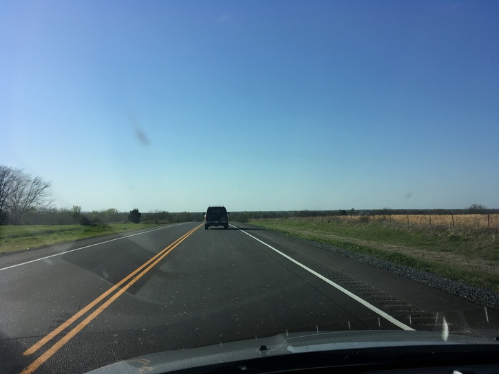
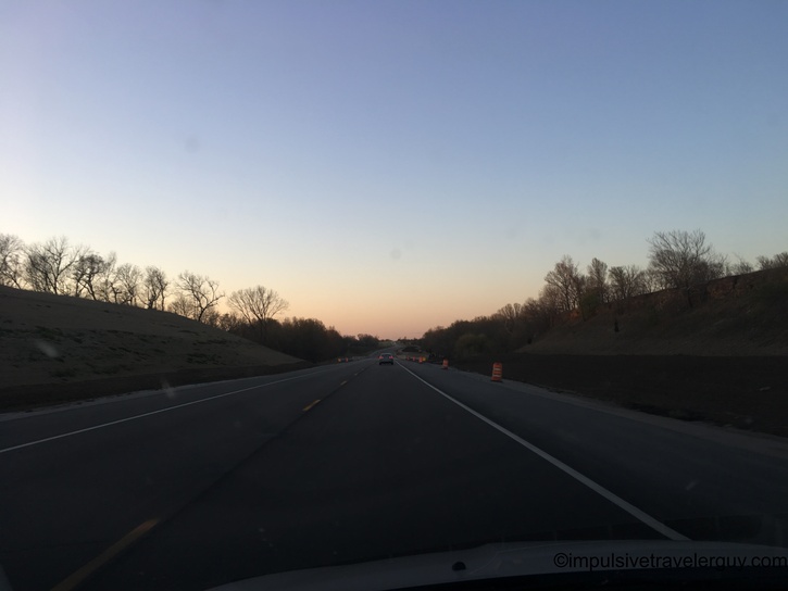
I got through Tulsa fast, and it was back to the middle of nowhere driving. The sun was starting to set, so it was very scenic. The weird thing is I had no clue what state I was about to go into. As I eventually got closer to Kansas, there would be signs for "state line." I didn't know if it was Kansas or Missouri I'd be going through. I just knew whatever state line was getting closer as I drove.

Highway view at sunrise or sunset with long shadows across pavement and flat prairie landscape Rural two-lane road at dawn with power lines and bare trees silhouetted against orange-pink sunrise sky Straight rural highway at sunrise with electrical substation and power lines visible alongside road Highway at dusk cutting through wooded hillsides with orange construction barrel and distant vehicles Rural two-lane road at sunset with blue directional sign and bare trees against colorful evening sky

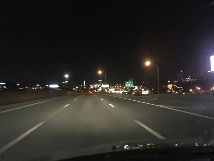
The state ended up being Kansas. I got to Kansas, and it started getting dark. I took some pictures of the prairie and then drove more in the dark. My goal was to get past Kansas City and then spend the night at an interstate rest stop.

Rural highway illuminated by headlights at dusk with oncoming vehicle lights visible ahead Rural landscape at twilight with crescent moon, water tower, and communication tower silhouetted against gradient sky Night highway driving with headlights illuminating lane markings and green highway sign barely visible Night highway approach to small city with commercial lights and signs visible in distance Multi-lane highway at night with street lights and commercial development illuminated along roadside

I made it to the rest stop and slept for the night. It was around 30 degrees when I woke up in the morning. I bundled up and actually slept pretty well. After sleeping, I hit the road and tried to get to Wisconsin as soon as possible.

Silver Ford Focus sedan parked at rest stop at night with headlights on Driving view at sunrise with bright sun low on horizon causing lens flare through windshield Weather app showing Holt, Missouri (near Kearney) at 31°F with hazy conditions, wind speed 5 mph, and Kansas City location marker Highway view with large blank billboard against bright sunny sky and flat agricultural fields Four-lane divided highway through flat agricultural land under clear blue sky

I started seeing a little bit of snow north of Des Moines. The further north I drove, the more was piled up.

View from car interior showing dashboard and flat winter agricultural landscape through windshield Highway view across flat agricultural fields with patches of snow visible alongside roadway Highway approaching overpass with snow-covered embankment and winter vegetation along roadside Four-lane divided highway through snow-covered farmland with tall communications tower visible on flat horizon Highway with snow banks alongside roadway, farm buildings and evergreen windbreak visible in distance Two-lane highway through winter landscape with snow-covered fields and bare trees under clear blue sky Winter rest area with picnic tables covered in melting snow beneath bare trees with patches of grass showing Wooden pedestrian bridge crossing over snowy landscape with building and parking area visible in background Highway rest area parking lot with red semi-truck, white trailer, and snow-covered hill with evergreen trees Wooden observation deck or walkway closed with chain barrier, snow and ice visible on surface with flooded area beyond View from elevated wooden walkway overlooking winter valley landscape with bare trees and patches of snow Highway cutting through snow-covered hills with forested slopes on both sides under blue sky Winter highway through hills with steep rock cut on right side showing exposed stone layers and snow accumulation Highway alongside dramatic ice formations on rock face with long icicles hanging from cliff wall Interstate highway approaching Wisconsin Welcome Center rest area sign with snow banks and bare trees along roadside Four-lane divided highway through rolling snow-covered agricultural landscape with distant hills visible

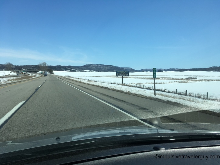
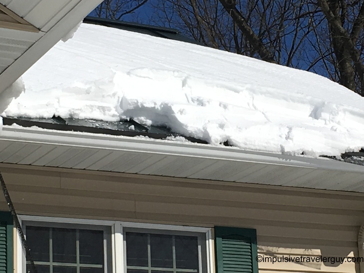
When I got to Wisconsin, my directions started getting dumber. My GPS avoiding tolls ended up wanting me to also avoid civilization. The sad thing is there aren't any tolls in Wisconsin, but you can read about my dirt road adventure here. I pretty much took the back roads to my parent's house. I then got there and saw there was still a lot of snow piled up.

Highway view with speed limit 55 sign and snow-covered hills with scattered trees in rural winter landscape Small Wisconsin town residential street with hospital sign, snow banks, and houses lining both sides of road Rural highway through winter agricultural landscape with snow-covered fields and distant hills under clear sky Two-lane highway through cut between hills with rock face visible, following blue semi-truck ahead Curved highway through forested winter landscape with snow banks and mixed evergreen and deciduous trees Straight rural highway lined with evergreen trees and deep snow banks on both sides stretching into distance Silver Ford Focus sedan parked at wooded rest area with snow on ground and winter forest in background Snow-covered rest area parking lot with multiple footprints and tire tracks, bordered by bare winter trees Weather app showing Sherwood, Wisconsin (near Marshfield) at 46°F with mostly cloudy conditions, wind speed 10 mph, and Wisconsin map location View through horizontal window blinds showing hotel building and snow-covered ground with bare trees outside Deep snow drift piled against house exterior wall next to shoveled walkway with woods in background Large overhanging snow drift on house roof edge threatening to fall over porch and windows Person using roof rake with long pole to remove heavy snow accumulation from house roof overhang Heavy snow load on house roof overhang above windows with bare trees and blue sky in background Person in winter clothing using roof rake to clear snow from two-story house roof with forest backdrop Close-up of thick snow and ice accumulation on roof edge and gutter system of house

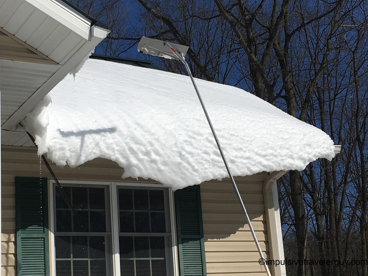
The temperature change was going to be interesting to deal with. At least things were supposed to warm up, but it was going to take a little getting used to. I know I've blogged about how much weather changes on a cross-country drive. While I didn't run into any bad weather along the drive, I could see spring this year looks very different between Texas and Wisconsin.

See more blog entries here